
Tumwater ZIP Code Coverage, With Cautions
The strongest official evidence for incorporated Tumwater is narrow. The city GIS address layer exposes 98501 and 98512 as coded values, and the Thurston County ZIP and post-office map also shows both. Other nearby numbers can appear in postal, association, or urban-growth contexts, but the research did not prove that each serves a standard-delivery address inside the city.
| ZIP | Area evidence | Postal city or office clue | How to use it |
|---|---|---|---|
| 98501 | Present in the official Tumwater address layer | USPS material routes it under Olympia | Verify the full address; do not infer city limits from the label |
| 98512 | Southern and western Tumwater contexts; city GIS and county map | Postal city may still read Olympia | Compare USPS result with city and parcel fields |
| 98511 | Tumwater PO Box association appears in local addresses | PO Box clue only | Standard-delivery geography remains unverified |
| 98502 | Broader Thurston and possible urban-growth context | Olympia postal ZIP | No supported incorporated-city claim |
| 98503 | Adjacent Lacey-area context | Lacey-area postal clue | No source inspected proves a Tumwater city address |
For that reason, this ZIP code directory does not inflate the list with nearby codes. It distinguishes confirmed city-layer values from numbers that still need an address-level USPS result.
Why Olympia Can Appear on a Tumwater Mailing Label
A postal city is routing metadata. It is not the boundary of an incorporated city. USPS may return Olympia for an address that Tumwater GIS codes to Tumwater, while the county parcel report supplies its own city-status and jurisdiction fields. Display both labels with their source instead of forcing one to replace the other.
This is a defining Tumwater ZIP code quirk. Tumwater is contiguous with Olympia, and its planning geography extends through named areas and an urban-growth boundary. Postal systems organize delivery; municipal maps organize government jurisdiction. The answer changes with the question being asked.
Boundary check. A correct mailing city can coexist with a different incorporated-city field, so preserve both labels and cite each source.
Use the USPS Tumwater ZIP Code Search Fields
The USPS ZIP Code Lookup supplies three routes. Use the full-address mode when a particular location matters. A city and state search can return multiple numbers, while the cities-by-ZIP route explains a postal label but does not resolve municipal jurisdiction.
| Lookup mode | Fields | Best use | Limit |
|---|---|---|---|
| By address | Optional company; required street, city and state; optional unit and ZIP | Confirm routing for one public address | Does not prove a person or company is there |
| By city and state | City and state required | See ZIP choices tied to a postal city | Multiple results need address-level follow-up |
| Cities by ZIP | ZIP required | Interpret the preferred postal city | Postal city is not a city-limit decision |
The official capture below shows the lookup surface used for this Tumwater ZIP code directory.
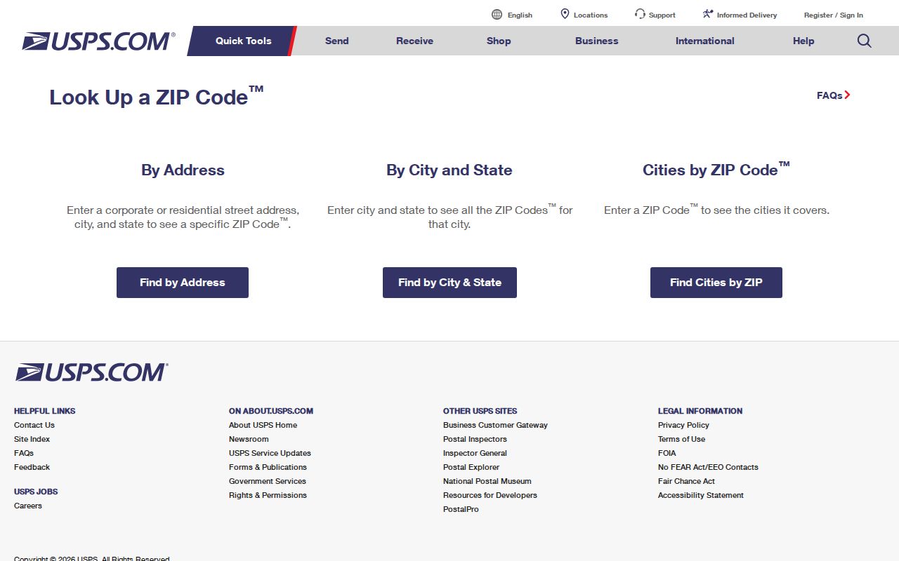
A result should be saved with the address entered, returned city, ZIP, and check date, then compared with municipal GIS.
Tumwater GIS Adds City and Address Status
The Tumwater GIS program publishes an official address layer named OfficialTumwaterBasemap_0925. It exposes address, ZIP, city code, location type, status, address type, parcel, building, and unit data. This is more useful than a bare ZIP because it can distinguish a current address from a pending or retired feature and a building from a unit.
| GIS field | Observed values or role | Research use |
|---|---|---|
| CITY | TUM, OLY, THUR | Keep the coded jurisdiction label |
| ZIP | 98501 and 98512 exposed | Filter confirmed layer records |
| LOCATION | Building, parcel, unit, condo, office, suite and others | Understand what the point represents |
| STATUS | Current, pending, retired | Avoid treating every feature as active |
| ADDRESS_TYPE | Residential, commercial, industrial and others | Preserve the source category |
| Parcel/building/unit | Linked identifiers | Move from postal geography to a county record |
The layer is a geographic reference, not a legal survey and not a resident roll. A practical sample should use a public facility, such as City Hall or the library, rather than exposing a private household.
Find Tumwater Residents Within One ZIP
A ZIP-wide search begins with geography and ends with a source-specific record. The same number can cover many streets and can cross boundaries. Narrow gradually, keep the role labels, and do not treat an owner, voter, or permit applicant as the same kind of match.
- Verify a known public or relevant address in USPS full-address mode, including suffix and unit.
- Query the city GIS ZIP field and record CITY, STATUS, LOCATION, parcel, building, and unit values.
- Open the Thurston County parcel map or A+ report for the parcel, keeping situs and mailing fields separate.
- If voter information is appropriate, use the official state extract request and obey its purpose and data restrictions.
- Once the set is narrowed to a road, continue with the Tumwater street directory rather than stretching a ZIP result into an address claim.
A ZIP code directory provides a search partition. It does not show household members, prove present occupancy, or make restricted fields public.
Voter ZIP Data Has a Separate Access Rule
VoteWA is an individual account service that requires matching first name, last name, date of birth, and an active registration. It is not a public ZIP browser. The Washington voter registration database extract is the proper public-list route. It contains active voters, public address, year of birth, district and precinct, and current and prior-year voting history, and is updated near the beginning of each month.
The state withholds full birth date, driver-license number, the last four Social Security digits, registration source or office, and the DOL opt-out choice. Advertising and solicitation uses are unlawful. A request is generally fulfilled within five business days, often by an email download link. Thurston Elections also provides in-person, mail, phone, and email access through Voter Services at 2915 29th Avenue SW in Tumwater.
The VoteWA screen below is useful for recognizing the individual account route, not for collecting a ZIP-wide list.
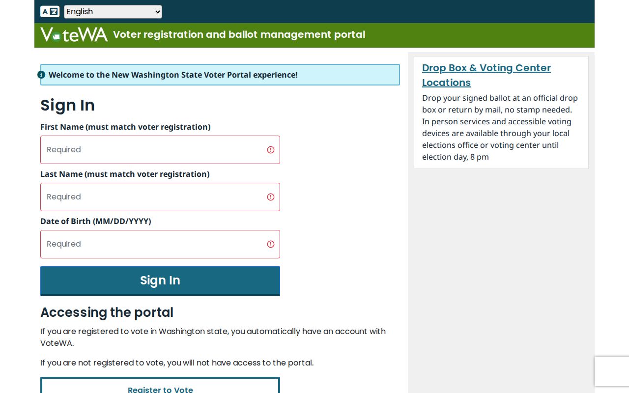
Use the VRDB process for a lawful public extract and never publish an individual's account session.
Tumwater Address Suffixes Check ZIP Results
Local addressing conventions offer a quick error test before repeating a failed lookup. West of Capitol Boulevard, street suffixes use SW; east of it, they use SE. East-west grid routes are generally Avenues, north-south routes Streets, and diagonal or non-grid routes Drives. Places run north-south between Streets, while Ways run east-west between Avenues.
Courts are cul-de-sacs, Loops are small loops, and Lanes are private roads. New-building numbers are assigned during the building-permit process. Preserve the spelling and directional suffix from the source. A missing SW or SE can send a USPS or parcel query to a different context, but a normalized spelling should never overwrite the historical form in the record.
Annexations Do Not Rewrite Tumwater ZIP Codes
Tumwater records provide useful date anchors for incorporated geography. Littlerock Road annexation took effect January 9, 2018; 806 Yelm Highway on June 4, 2018; and Sapp Road on September 11, 2018. The city completed-annexations map covers changes from 1916 through 2022, and ordinance records are available through the Tumwater Records Center.
The city's guidance states that annexation does not affect ZIP codes. Therefore, an unchanged ZIP cannot date when a parcel entered the city. Use the annexation ordinance and effective date for that question, then use USPS only for the postal label. This comparison is more reliable than assuming a familiar city name has always represented the same jurisdiction.
ZIP Boundaries and Tumwater City Limits
The terms below explain why a Tumwater ZIP code result cannot carry more meaning than USPS gives it. A ZIP is a delivery construct, while incorporated limits come from municipal and county geography. ZIP+4, routes, and box assignments refine mail handling without creating civic borders.
- ZIP and ZIP+4
- A ZIP groups delivery geography; ZIP+4 narrows a segment such as part of a street, building, or box group.
- PO-box ZIP
- A number or use associated with post-office boxes rather than a proven standard-delivery area.
- Unique ZIP
- A ZIP assigned to a single high-volume organization; none was verified here for Tumwater.
- Carrier route
- A postal delivery path that may cross the neighborhood or civic lines used by other maps.
98511 remains a PO Box clue in this research, not a confirmed standard-delivery polygon. Likewise, the evidence does not support adding 98502 or 98503 to an incorporated-city list. Verify each full address and date the evidence.
Use boundaries honestly. Never infer a person's exact location or current residence from a ZIP-wide match or a postal-city label.